



Maps & Atlases
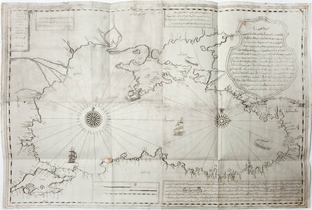
Ibrahim Müteferrika
Bahriye-i Bahr-i Siyah (Naval Chart of the Black Sea)
Printed from four copper plates.
Total size: c. 65 x c. 95 cm.
Kostantiniyye [Istanbul], 1137 [1724/25]
Provenance: German private collection
This map, unlike his books, is apparently not mentioned in the probate inventory of Müteferrika’s possessions at his death in 1747 (Sabev 2007). According to Toderini (1787), who acquired a copy, probably in the 1770s, the engravers were Ahmed of Crimea and Migridiz of Galata (an Armenian, according to Babinger 1919), and the plate was prepared, scrutinised and improved by the ablest geographers, before being printed by Müteferrika. According to Lüdeke (1789), it was priced originally (together with two other maps) at around...
more »
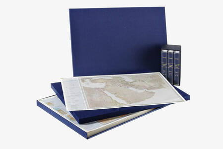
Tübingen Atlas of the Near & Middle East (Tübinger Atlas des Vorderen Orients, TAVO)
– ARCHIVE EDITION IN CLOTH-COVERED CASES –
295 sheets in 2 cases with 3 vols Index
Over a period of 30 years more than 250 scholars have contributed to the largest cartographical project on the Near and Middle East ever. The Atlas covers the Near and Middle East from the European parts of Turkey down to Sudan, from the Arab Peninsula up to Central Asia. Part A, Geography & Cultural Anthropology, covers the geography of the Middle East, as well as climate, geology, settlement, religion and economy. Part B, History, covers all periods of history from the Stone Age, the Romans, the Expansion of Islam a...
more »
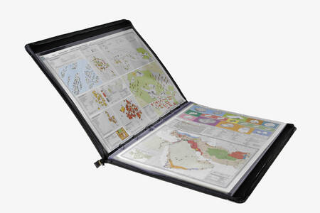
Tübingen Atlas of the Near & Middle East (Tübinger Atlas des Vorderen Orients, TAVO)
– PORTFOLIO EDITION –
Arranged for library use in 7 portfolios, each map in plastic sleeve, with 3 vols Index
Over a period of 30 years more than 250 scholars have contributed to the largest cartographical project on the Near and Middle East ever. The Atlas covers the Near and Middle East from the European parts of Turkey down to Sudan, from the Arab Peninsula up to Central Asia. Part A, Geography & Cultural Anthropology, covers the geography of the Middle East, as well as climate, geology, settlement, religion and economy. Part B, History, covers all periods of history from the Stone Age, the Romans, the Expansion of Islam a...
more »
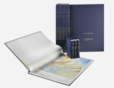
Tübingen Atlas of the Near & Middle East (Tübinger Atlas des Vorderen Orients, TAVO)
– HARDCOVER EDITION IN 15 VOLUMES –
Bound in 12 volumes with 3 volumes Index
Over a period of 30 years more than 250 scholars have contributed to the largest cartographical project on the Near and Middle East ever. The Atlas covers the Near and Middle East from the European parts of Turkey down to Sudan, from the Arab Peninsula up to Central Asia. Part A, Geography & Cultural Anthropology, covers the geography of the Middle East, as well as climate, geology, settlement, religion and economy. Part B, History, covers all periods of history from the Stone Age, the Romans, the Expansion of Islam a...
more »
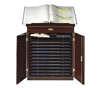
Map Cabinet for Tübingen Atlas of the Near & Middle East (Tübinger Atlas des Vorderen Orients, TAVO)
Hand crafted map cabinet with 13 drawers for atlas and index, 2 doors with lock, mahogany (or other) veneer, brass mountings, reading desk with leather inlay. Following the example of Napoléon’s famous “Description de l’Égypte” we have tailor made a cabinet for our twelve volume hard cover edition of the Tübingen Atlas of the Near and Middle East (Tübinger Atlas des Vorderen Orients or “TAVO”). Each cabinet is hand made. This elegant TAVO map cabinet can be used for transportation, storing and reading as it is equipped wit...
more »